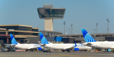




Global airspace has already become busier than it was before the pandemic. According to OAG, an average of more than 103,000 commercial flights operate every day, and that figure is expected to increase further in the coming decades. The International Air Transport Association has forecasted that global air passenger demand could more than double by 2050.
Indeed, the North Atlantic is one of the busiest aviation corridors in the world, with hundreds of aircraft crossing between Europe and North America every day. Managing this volume of traffic requires carefully planned routes, strict separation standards, and coordination between pilots and air traffic controllers.
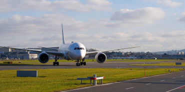
On flight tracking maps, these routes often look like straight lines running parallel to each other. However, some aircraft are deliberately flying slightly offset from the center of their assigned track, sometimes by just a mile or two. If you follow British Airways’ Boeing 787 flights across the North Atlantic, you may notice the same pattern, and that is entirely intentional.
In oceanic airspace, flying offset simply means an aircraft operates slightly to one side of its cleared track, typically one or two nautical miles (1.85–3.7 kilometers) to the right. It may look unusual on a flight tracker, but it is a standard operating procedure used by airlines flying across the North Atlantic and other oceanic regions. The reason is that flying over the ocean is very different from flying through radar-controlled airspace.
Over land, air traffic controllers can continuously monitor aircraft and adjust separation as required. Traditional radar coverage, however, does not extend across vast oceanic areas, so aircraft instead rely on a combination of satellite-based surveillance, datalink communications, onboard navigation systems, and established procedures to maintain safe separation throughout the crossing.
Therefore, in the absence of continuous radar surveillance, aircraft crossing the North Atlantic follow a series of standard operating procedures designed to maintain safe separation. One of those is the Strategic Lateral Offset Procedure (SLOP).
The procedure allows pilots to fly one or two nautical miles to the right of their assigned track instead of remaining directly on the centerline. The offset is selected before entering oceanic airspace and programmed into the aircraft’s Flight Management System, which allows the autopilot to maintain the selected path automatically for the crossing.
The idea behind the SLOP is based on a simple principle: aircraft should not all occupy exactly the same point in the sky when following the same route. Modern navigation systems are extremely accurate; they allow aircraft to follow their assigned tracks with a level of precision that was not possible in the earlier days of aviation. Undoubtedly, this has made flight operations safer, but it also means that aircraft following the same route are increasingly likely to fly along almost identical paths.
This is sometimes referred to as the navigation paradox, where such accuracy can actually increase collision risk if something goes wrong. A navigation error, an unexpected altitude deviation, or an incorrect clearance could place two aircraft on conflicting paths. So, to address the issue, the International Civil Aviation Organization introduced the SLOP in the early 2000s. The procedure was adopted across some of the world’s busiest non-radar airspace, including the North Atlantic.
Since then, crews have been able to select a one- or two-nautical-mile offset before entering oceanic airspace. Indeed, the navigation paradox was the primary reason for introducing the SLOP, but the procedure has other advantages. It can reduce the likelihood of wake turbulence encounters and provides additional space during situations where a crew cannot immediately maintain its assigned altitude.
Getting the plane in the air is just the start…
Indeed, the SLOP procedure itself is straightforward. Once the selected offset is entered into the aircraft’s system, the autopilot maintains the adjusted path automatically for the remainder of the oceanic crossing. It does not require a significant change in workload and has no noticeable impact on flight time or fuel consumption.
However, flying through oceanic airspace requires crews to carefully monitor several aspects of the flight before and during the crossing. Using a British Airways Boeing 787 service from London Heathrow to New York JFK as an example, the flight operates within the North Atlantic Track system, which is a network of routes used by airlines traveling between Europe and North America.
These tracks are managed by Shanwick Oceanic Control (United Kingdom) and Gander Oceanic Control (Canada) and are updated daily based on factors such as winds, weather conditions, and traffic levels. Before entering the North Atlantic airspace, the first thing pilots need to obtain is their oceanic clearance from the appropriate clearance delivery.
At least 40 minutes before Oceanic Entry Point
At least 20 minutes before Oceanic Entry Point
This clearance includes important details for the crossing, including the assigned route, estimated time over significant point (ETO), flight level, and Mach number. Normally, voice clearances are obtained at least 40 minutes before oceanic entry, while clearances received through data link are typically obtained between 30 and 90 minutes before entry. Once the clearance is received, both pilots review the details and confirm that they match the route loaded into the aircraft’s navigation system.
The crew also verifies each waypoint and coordinates before entering oceanic airspace. Once established in oceanic airspace, crews continue to perform regular checks to monitor the aircraft’s position and performance throughout the crossing. This includes confirming that the primary altimeters remain within 200 feet of each other during level flight and maintaining the assigned Mach number as closely as possible, with any deviation of 0.02 Mach or more reported to air traffic control.
Furthermore, crews continuously monitor another important part of oceanic operations: Equal Time Points. For those who are not familiar with the term, these are calculated points along the route where the time required to continue to the destination is the same as the time required to divert to a suitable alternate airport. In simple terms, they help pilots decide whether it is quicker and safer to continue the flight or turn towards a diversion airport if an emergency occurs.
Equal Time Points are calculated before departure and are based on different scenarios, including medical emergencies, engine failures, and depressurization. Crews operating transatlantic flights already know their available diversion airports before departure and continue to review them throughout the crossing. The choice depends on factors such as the route being flown, the aircraft’s position, weather conditions, runway availability, and the nature of the emergency.
Some common diversion airports on North Atlantic routes include Gander and St. John’s in Canada, Keflavík in Iceland, and Lajes in the Azores. The latter is particularly important due to its location near the NAT. It has a 10,870-foot (3,330-meter) runway, operates 24 hours a day, and has emergency services available around the clock. It is worth noting that if a diversion or turnback becomes necessary, crews need to follow established contingency procedures designed for oceanic airspace.
For instance, if the aircraft needs to leave its assigned track and cross the flow of North Atlantic traffic, it first establishes a 15-nautical-mile (28-kilometer) offset from the cleared route before climbing above Flight Level 410 or descending below Flight Level 280. This provides additional separation from other aircraft operating on nearby tracks.
The route involves crossing a large portion of the Pacific Ocean.
North Atlantic Clearance Procedures Are Now Changing
With all this being said, the procedures that allow aircraft to safely cross the North Atlantic have changed significantly over the years and continue to evolve. In fact, the ICAO regularly (sometimes multiple times a year) updates NAT Doc 007, which is the main guidance document for operations over the North Atlantic. One of the biggest procedural shifts currently taking place in the North Atlantic region is the move away from traditional oceanic clearance processes.
As noted previously, the current system requires crews to obtain specific oceanic clearances before entering the airspace. This is now gradually being replaced by a process where aircraft can be cleared based on their filed flight plan. The move towards Oceanic Clearance Removal was announced by ICAO in 2024, and all five North Atlantic Oceanic Control Areas (Shanwick, Gander, Reykjavik, Bodø, and Santa Maria) were expected to transition to the new system.
Most have already moved away from the traditional process, but Shanwick has not yet implemented Oceanic Clearance Removal. The change was initially expected to take place in 2025, but it has since been delayed.
While the latest ICAO guidance does not specify a date, Shanwick has separately confirmed that OCR is not expected to begin before summer 2026, as reported by OPS Group. Until then, crews operating through Shanwick would need to continue to request and receive an oceanic clearance as they do today. Furthermore, under the new process, the Request for Clearance message provides air traffic control with the information needed to sequence traffic and maintain separation.
However, it has highlighted some challenges. In some cases, pilots misunderstood the submission of a Request for Clearance as permission to climb or descend to the requested level without first receiving an appropriate ATC clearance. To remove that confusion, Reykjavik discontinued the requirement altogether this year. With that being said, the change does not apply uniformly across the entire North Atlantic region, as other oceanic control areas continue to use them as part of their existing procedures.
In conclusion, if we look at a British Airways Boeing 787 flight from London Heathrow to New York JFK, or any other transatlantic service, most of us assume that the aircraft is simply cruising across the Atlantic on autopilot. However, the crew is operating within one of the busiest and most carefully managed airspaces, especially without conventional radar coverage over the Atlantic.
When an aircraft enters a no-radar zone, pilots rely on a combination of navigation systems, datalink communication, position reporting, and procedures developed specifically for oceanic operations. The SLOP is one part of that system, under which crews can fly one or two nautical miles to the right of their assigned track.
These small offsets add another layer of safety by reducing the risk of aircraft occupying the same position in the event of a navigation error, unexpected altitude deviation, or other situation. As such, when a British Airways Boeing 787 appears slightly off course on a flight tracker, it is not a deviation or a mistake. It is the result of a carefully planned procedure that allows thousands of aircraft to safely cross the Atlantic every year.
Found an error? Send it info@simpleflying.com so it can be corrected.
Orijinal Haberi Görüntüle